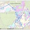
Analyzing the Loonse and Drunense dunes using remote sensing
Students at Avans University of Applied Sciences have been tasked with analysing the health of the Loonse and Drunense dunes by means of aerial imagery, such as drone and satellite imagery.
