Skip to main content Skip to main navigation
Government logo | to homepage of Rijksinstituut voor Volksgezondheid en Milieu Ministerie van Volksgezondheid,
Welzijn en Sport
  • EN
  • NL
Atlas Natural Capital
  • Home
  • Kaarten
  • News
    • Nieuws
    • Nieuwsbrieven
  • Natural Capital
  • Examples
  • Join us
  • Dossier
  • Home
  • News

News


Search

Fill in your search phrase.

Topics

Publication date

  • January 2021 (1)
  • December 2018 (1)

Analyzing the Loonse and Drunense dunes using remote sensing

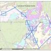
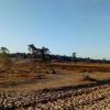
 Students at Avans University of Applied Sciences have been tasked with analysing the health of the Loonse and Drunense dunes by means of aerial imagery, such as drone and satellite imagery.
01/19/2021 - 15:18
kaart van de Loonse en Drunense duinen met de vlakken die met remote sensing gefotografeerd zijn

Nitrogen in the Loonse en Drunense duinen

Values are exceeding, but what does this mean, and why should we be concerned?

12/05/2018 - 12:36

Share this page


  • Facebook
  • Twitter
  • LinkedIn
  • WhatsApp
  • Email

Service

  • Archive
  • Contact
  • Help
  • FAQ

About this site

  • Colophon
  • Cookies
  • About ANK
  • Partners
  • Privacy & proclaimer
  • Responsible disclosure
  • Accessibility

Other atlasses

  • Atlas Living environment
  • National Energy Atlas